Tomer’s Take
- Storm #2 is exiting Colorado. Next stop is the Northeast ski areas Thursday night-Friday.
- Tiny wave of light snow races through MT, ID, WY, UT, CO through 2/25 then high pressure rebuilds.
- Storm track shifts into the PNW and B.C. 2/25-3/1. It grows to include northern ID and western MT.
- Then it gradually shifts south to include most of CA, UT, WY, and CO after 3/3.
Colorado Totals & SWE
3-Day Storm Cycle Snow Totals:
- Wolf Creek: 43″ (SWE 3.9″)
- Silverton Mountain: 44″ (SWE 3.1″)
- Purgatory: 45″
- Telluride: 30″
- Snowmass: 32″
- Crested Butte: 20″
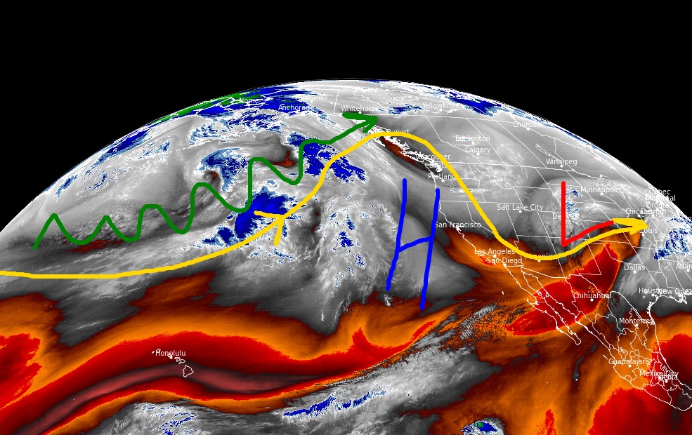
Current Setup
Water vapor satellite shows the dip in the storm track over the north Pacific headed for the PNW and B.C. this weekend. Orange/red colors = drier air aloft.

Early March
The storm track will gradually shift south from the PNW into ID, MT, WY, CA, UT, and CO. This occurs between 3/1 and 3/10. Below, notice the lower forecast pressure anomalies on 3/7/2022 across the West. The lowest pressures maximize around 3/10.

Snow Forecast
2/24-2/28:

3/1-3/5:

Northeast, 2/24-3/5:
Most of this accumulation occurs on 2/25.

For more analysis please watch my forecast video:
What is SWE?
Hi Steve, Snow Water Equivalent. Chris
Snow water equivalent
Thanks, Lynn! Chris