Tomer’s Take: Heavy snow accumulation hits UT PM 2/19-2/21. Light to moderate snow accumulation for the Tetons PM 2/19-2/20. Colorado gets light snow accumulation 2/20 and moderate snow 2/22. California continues to receive heavy snow accumulation now through 2/20. Then the pattern shifts on/after 2/25 with the Northern Jet Branch buckling, merging with the Southern Branch, a preferred NW Flow, and additional energy delivery. Big widespread totals likely. If this spills into early March then it’ll be a solid start.
My mountain weather update video:
Current Setup
Water vapor satellite shows a large trough of low pressure hitting CA. It’s sending waves of snow into the interior Rockies. The entire storm system breaks loose 2/20-2/22 through UT/WY/ID/CO.
The area of low pressure in the North Pacific will become part of the 2/25-2/28 Northern Branch setup.
Orange/red = drier air aloft.

Forecast Jet Stream
Forecast Radar & Satellite
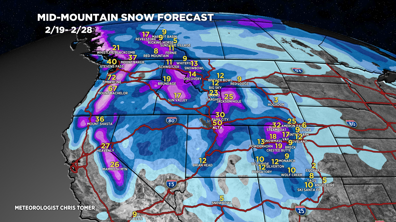
Forecast Totals
Grand Totals by late 2/28.


