Tomer’s Take: Two pieces of energy will merge somewhere over UT/WY/CO 12/23-12/24. The timing and placement of the merger determines total snowfall for UT, WY, CO, NM.
My video forecast update:
Current Setup
Water vapor satellite shows both pieces of energy and eventual merger zone.
Orange/red = drier air aloft.

Forecast Jet Stream
Notice the trough over WY/UT/CO.

Powerful Pacific flow and jet power. Active New Years pattern into January 2024.

Forecast Radar & Satellite
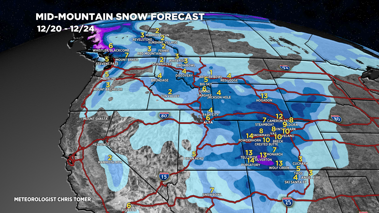
Forecast Totals
*Updated 2:30pm 12/20.
WY Snow: 12/23-12/24.
UT Snow: 12/23-12/24.
CO Snow: 12/23-12/24.

*Update 2:30pm 12/20.
CA Snow: 12/27-12/29.

*Updated 2:30pm 12/20.
Storm system 12/26-12/28 appears warmer with mostly rain.

Hello Chris,
Any insights on snow for southern ID? Sun Valley in need.
Thank you.
Hi Duncan – I hear you…unfortunately, I’m only forecasting light snow chances for Sun Valley late 12/22 into early 12/23 and light snow on 12/28. The pattern does look more active in JAN 2024. Chris