Tomer’s Take: A strong storm system spins up in SE CO/NM tonight through 3/25 with heavy snow accumulation and 30-50mph wind gusts. The heavy snow continues into 3/26 in NM.
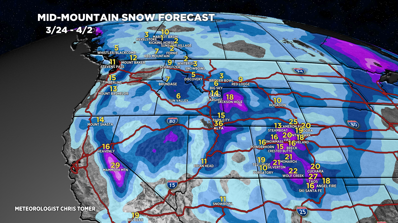
There are three additional storm systems lined-up for the West through 4/2.
Timing
Sierra: H PM 3/27-3/31.
Tetons: L/M Tonight, L PM 3/25-3/26, H 3/28-3/30.
Wasatch: L Tonight-3/25, M/H 3/26, H 3/28-3/30.
Colorado: H Tonight – AM 3/25, H 3/26 – AM 3/27, H 4/1-4/2.
Denver, CO: Rain initially, falling temps, turns to snow until 5am 3/25, 40-50mph gusts, drier after 5am 3/25.
New Mexico: H Tonight-3/26, H 4/1-4/2.
My afternoon forecast video update:
Current Setup
Water vapor satellite shows the developing area of low pressure in SE CO/NM.
There are additional storm systems lined-up in the Pacific riding a strong jet stream.
Orange/red = drier air aloft.

Forecast Radar & Satellite
Forecast Totals
Grand totals by late 4/2.


