Tomer’s Take
- 2-3 day dry break across the Intermountain West (IW).
- Two storm combo hits the IW 2/20-2/23.
- An Arctic front accompanies this storm cycle. Air temps plummet early next week aiding in snow efficiency.
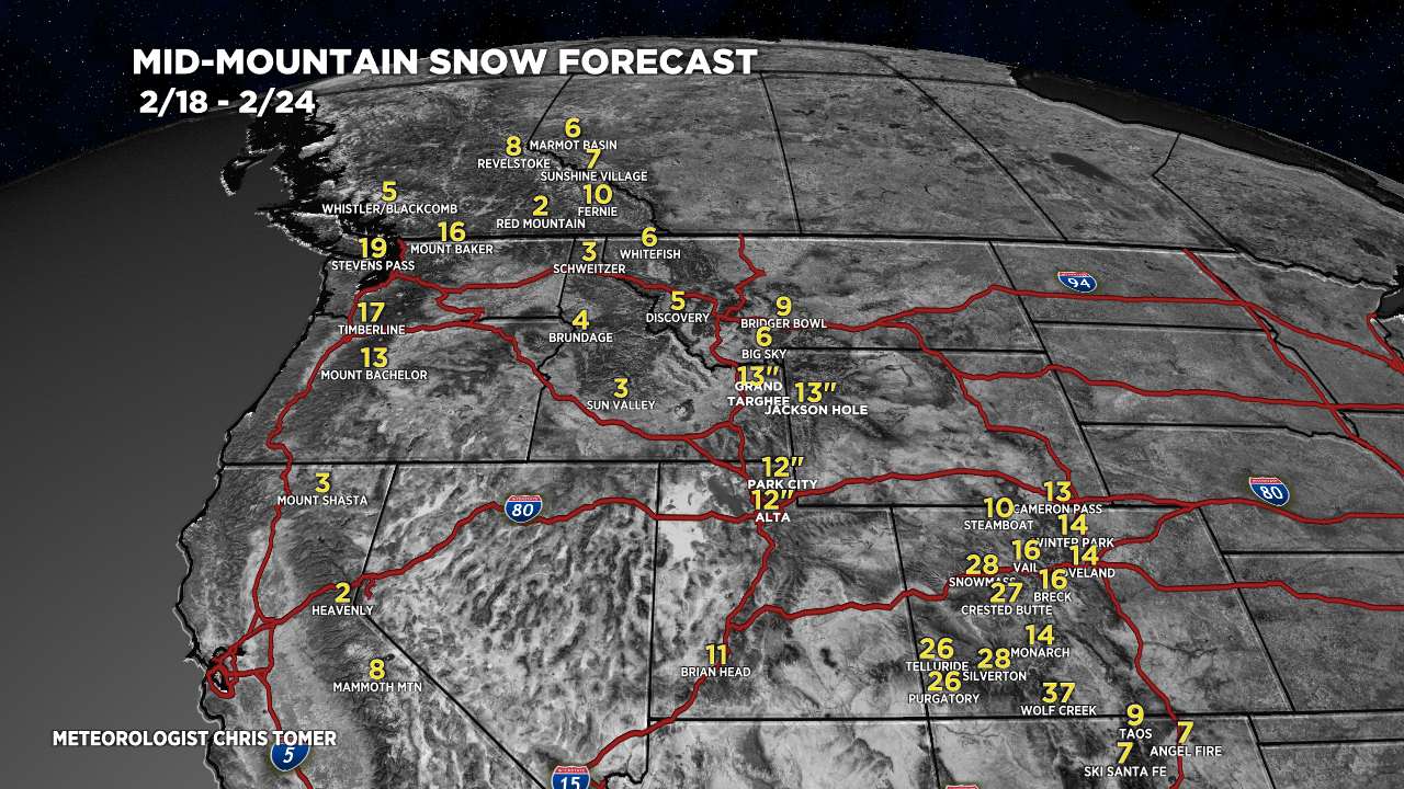
- 1-3 feet possible across parts of CO.
- A foot or more across the Wasatch and Tetons.
- What follows this storm cycle through March 1? Data remains split and confidence is low.
Infrared satellite shows the storm track and storm systems lurking for next week. They will drag and Arctic front down as well.

Storm Cycle
Below, notice the amplification of the jet stream valid 2/21-22/2022. The jet reaches into the Arctic and buckles south. Both storm systems will ride this storm track.

Snow Forecast
2/18-2/24:

2/25-2/27:

Forecast snow plume for Crested Butte, CO:

Northeast, 2/18-2/27:

For more analysis please watch my forecast video:
Hey Tomer!
Huge fan. I am tuned in daily. Thanks for all your hard work and attention to the snowy weather patterns. We in Bend would love to see a snow plume for Mt. Bachelor!
Super cool stuff! Keep up the awesome work!
Best,
Greg Norris
Thanks, Greg!
Thanks for the update!
You bet, thanks Cole!