Tomer’s Take
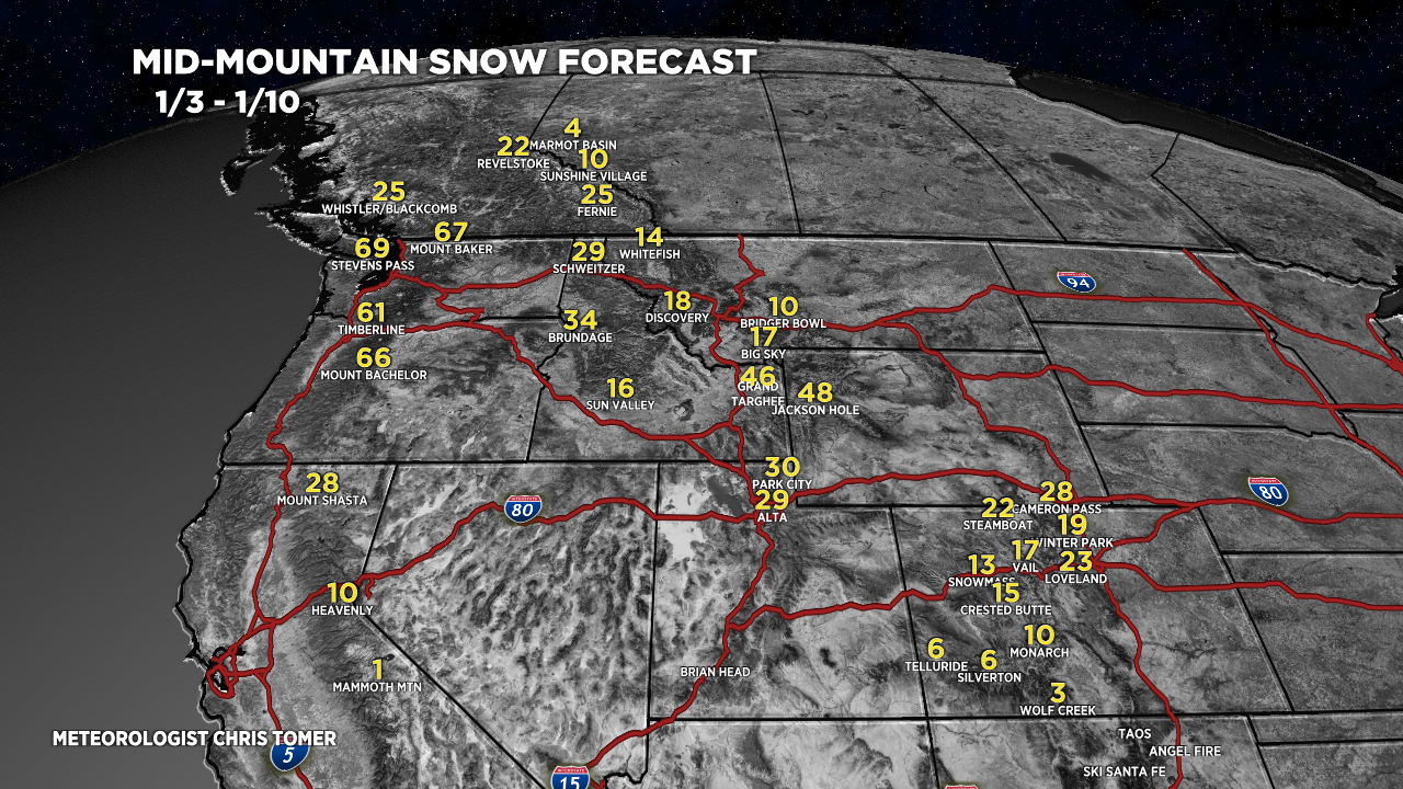
- Active jet stream with 3-4 storm systems for the PNW, B.C., ID, MT, and WY. Feet of total accumulation.
- Then, the storm track shifts south and hits northern Utah and the Central & Northern Mountains of Colorado with major snow accumulation (1/4-1/8).
- After 1/8, high pressure builds into the Intermountain West.
The key feature is the dipping jet stream and large trough of low pressure over the North Pacific. Pressures are running 2-3 standard deviations below the 30-year average. This means it’s significant.

Jet Stream
A powerful jet stream directs 3-4 storm systems into the PNW and northern tier of the Rockies.
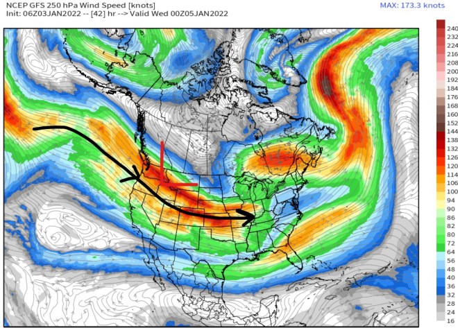
High pressure builds in after 1/8. Notice the splitting jet. Bigger storm system for the Northeast.

Snow Forecast
Total snow forecast 1/3-1/10:

Drilling down, here’s my snow plume for Alta, UT:

Jackson Hole, WY:

Wind
Powerful jet stream through 1/8 delivers strong wind along with the heavy snowfall.

For more analysis please watch my forecast video:
Chris thanks for what you do! I refresh often to see your daily posts! What is your opinion on the jetstream trend for next week 1/11-1/16? I have a trip out the the PNW (Alpental specifically) but will hold off if there’s a big warming trend. Cheers.
Hi Jordan – Pressures do look high during that timeframe in the PNW. But, it’s a long way out so let’s see if it holds. Chris