Tomer’ Take
- Two cold fronts pierce the eastern periphery of the western high pressure ridge through 1/25 favoring MT, ID, WY, UT, CO, NM.
- The overall pattern appears to flip by early February with lower atmospheric pressures and a dipping jet stream across the West.
- This would suggest a shift to a more active, colder weather pattern by early February.
Infrared satellite shows the storm track. It allows two cold fronts to brush MT, ID, WY, UT, CO, and NM through 1/25.

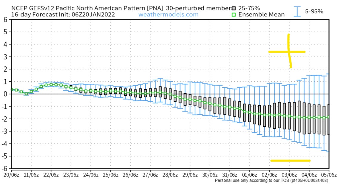
Early February
There are signs the overall pattern could flip across the USA. Lower pressures could replace the big high pressure across the West.

The Pacific North American Pattern (PNA) agrees. It turns negative, which can indicate a more active weather pattern across the West.

Snow Forecast
1/20-1/23:

1/24-1/29:

For more analysis please watch my forecast video:
thx Chris- enjoy your forecasts. Let’s hope for more snow soon.
Thanks, Judi! Chris