Tomer’s Take
- My forecast includes at least the partial merger of two storm systems over the 4-Corners between Thursday night and Saturday morning.
- Heavy snow in UT, CO, and NM between Thursday night-Saturday morning.
- In Colorado, the bullseye is Western Slope ski areas and San Juan ski areas.
- This final storm system will mark the end of this prolonged and historic storm cycle.
- The Intermountain West gets a brief 3-4 day dry break with snow returning quickly thereafter.
The infrared satellite shows the storm track and I marked the two storms systems that merge for New Year’s.

After this storm system departs on 1/1/2022, a small ridge of high pressure builds into the Intermountain West. This equates to a warmer, drier pattern for 3-4 days with snow returning quickly thereafter. Notice the drop in pressures off the West/PNW coast.

Snow Forecast
Let’s look at my snow forecast in two time-periods.
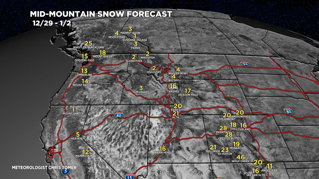
12/29-1/2:

1/3-1/7:

Drilling down, here’s my Aspen/Snowmass snow plume forecast:

For more analysis please watch my forecast video:
Good news Chris! Thanks for bringing us the manna from Heaven!
Yes! Thanks, Paul. Chris
Nothing for Winter Park?
Hi Lisa, I know WP is not on the map but still expecting snow there. 10-20″ by midday 1/1/2022. Chris
Chris what do you see happening in the South Park Como area?
Hi Kate – about 6″ in South Park/Como Friday-Saturday. More on the surrounding high peaks. Turning much colder Friday night through Saturday. Chris