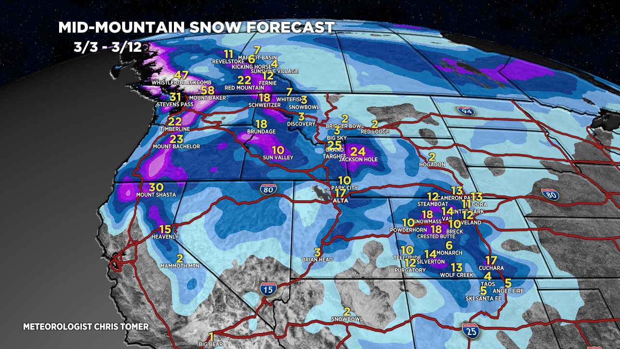
Tomer’s Take: 2nd wave of snow hits UT/WY/CO now through 3/4 with light to moderate accumulations (2-8″). Next storm system hits the Intermountain West 3/5-3/9 with moderate to heavy accumulation. Storm system could see enhancement in Colorado 3/8-3/9. Then the storm track shifts north to favor Northern CA, OR/WA/BC and Northern Tier 3/10-3/12.
Timing
Wasatch Another 2-4″ Now-3/4, 6-8″ 3/7.
Tetons Another 6-8″ Now-3/4, 1FT PM 3/5-3/6.
Colorado Another 3-8″ Now-3/4, 4-8″ 3/5-3/7.
Sierra 5-10 Feet Now – AM 3/5, Blizzard.
Northeast Rain 3/5-3/6, Snow 3/10-3/11.
My afternoon forecast video update:
Current Setup
Water vapor shows both storm systems. The first low is the bigger storm system generating the Sierra Blizzard.
Orange/red = drier air aloft.

Forecast Radar & Satellite
Forecast Totals
Forecast Grand Totals by late 3/12.


Northeast:
VT/NH/ME: Rain 3/6-3/7, snow 3/10-3/11.

Hey Chris you got a typo….tge storm shits north is what is there. And I agree it probably will, but shift is probably what you want😂
Thanks, Vickie! ;-D
Then the storm track shits north to favor Northern CA, OR/WA/BC…
Hmmm. I guess it will be a wet-messy-storm-system 😉 ~Adam