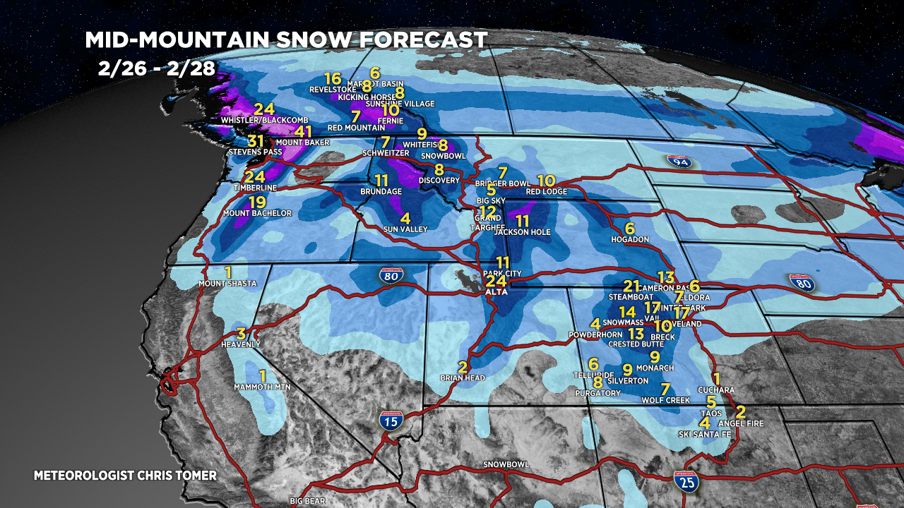
Tomer’s Take: The 2/26-2/27 storm system is trending weaker/faster but it’s still robust with heavy snow accumulation and strong wind in ID/WY/UT/CO. A second major storm system hits many of the same areas 3/2-3/4 with heavy snow accumulation.
My afternoon forecast video update:
Forecast Timeline
Storm #1 ->
Wasatch: 1-2FT 2/26 – AM 2/27.
Tetons: 1-2FT 2/26-2/27.
Colorado: 10-20 inches 2/26 – AM 2/27.
Idaho: 4-12 inches 2/26.
Storm #2 ->
Wasatch: 2FT 3/2-3/4.
Tetons: 1-2FT 3/1-3/3.
Colorado: 8-16 inches 3/3-3/4.
Idaho: 8-16 inches PM 2/29-3/1.
Current Setup
Water vapor satellite shows both jet branches roaring towards possible merger 2/26-2/27.
Orange/red = drier air aloft.

Forecast Jet Stream
Forecast Radar & Satellite
Forecast Totals


