Tomer’s Take: Two cold fronts remain on track to deliver snow and the coldest air of the season so far through 10/29. Snow totals in Colorado are trending higher 10/28-10/29.
Air temps in Colorado’s mountains drop below zero late 10/29 into 10/30.
Air temps in Wyoming’s mountains drop below zero 10/28, 10/29, 10/30.
My forecast video:
Snow continues at Timberline Lodge at Mount Hood, OR;

Current Setup
Water vapor satellite shows a large low pressure in the Pacific anchoring the pattern.
Storm System #1 is dropping south into the PNW.

Forecast Jet Stream
Forecast jet stream valid 10/28. Notice the trough and SW to NE orientation of the jet stream over CO.

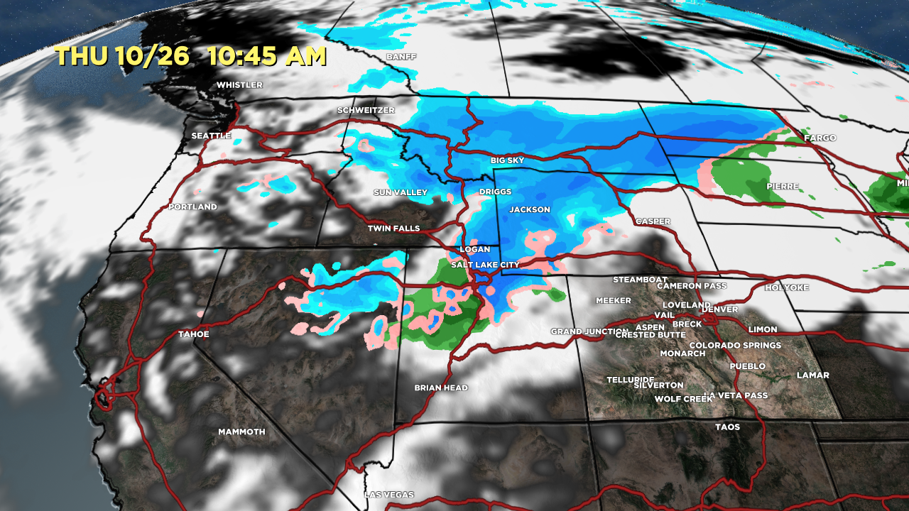
Forecast Radar & Satellite
Bulk of snow accumulation in the Wasatch occurs on 10/26.
Bulk of snow accumulation in the Tetons occurs 10/25-10/26.
Bulk of snow accumulation in Colorado occurs 10/28-10/29.
Full Movie:
Forecast Snowfall
*Updated 2:30pm 10/25
10/25-10/27

*Updated 2:30pm 10/25
10/28-10/29

Trending Up in CO
Why are totals trending up? It’s a combination of the coldest air of the season increasing efficiency, powerful jet stream support and conditional symmetric instability (CSI), and slower frontal movement. If this trend holds then I would expect snow squalls.
Examples ->
Snowmass:
10/27: Late 1-3″
10/28: 8-12″
10/29: Early 1-2″
Quandary Peak:
10/28: 4-8″
10/29: 4-8″
Longs Peak:
10/28: 6-12″
10/29: 2-4″
Berthoud Pass, CO Air Temperature Forecast:
