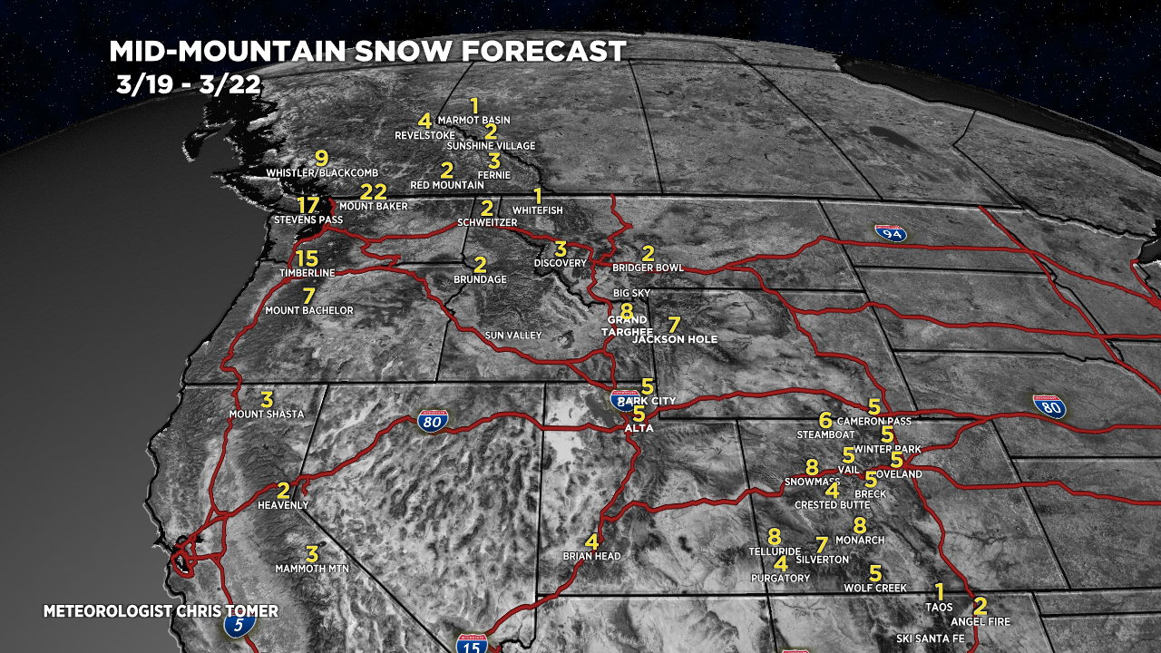
Tomer’s Take
- The next Western storm system hits the West Coast today 3/19.
- Then it moves east into ID, MT, WY, UT, CO, NM.
- Storm is trending weaker overall.
- In Colorado and New Mexico on 3/21, earlier notions of a strong, deep low pressure are becoming less likely.
- Then high pressure rebuilds.
Water vapor satellite shows the storm track and low pressure system hitting the West Coast.

Snow Forecast
3/19-3/22:

3/23-3/28:

Northeast, 3/19-3/28:

For more analysis please watch my forecast video: