Tomer’s Take
- Colorado bullseye spots: 8-10″ in the last 24hrs reported at Aspen/Snowmass, Crested Butte, Telluride, Silverton, and Wolf Creek. I’m forecasting another 1-2+ feet by Thursday morning. Wolf Creek might be the biggest winner with almost 4 total feet.
- Arctic air continues filtering in-between storm systems.
- Taos: 1-2 feet total by Thursday afternoon. Lull in snowfall between storm #1 and storm #2 on Wednesday morning. The sun might even come out. 70% of the grand total comes from storm #2 between Wednesday afternoon-Thursday.
- Wasatch: Another wave of accumulating snow arrives Tuesday night through Wednesday, 4-6″ new.
Crested Butte, CO is one of my bullseye spots for big totals. Looking good so far.

Wolf Creek, CO is on their way to almost 4 feet by Thursday afternoon. Heavy snow continues:

Infrared satellite shows the storm track and two-storm combo for the West. A few large low pressure systems are cruising through the North Pacific and will nail the PNW and B.C. (maybe even parts of CA) between 2/26-3/4 as the storm track shifts.

Snow Forecast
2/22-2/24:

2/25-3/2:

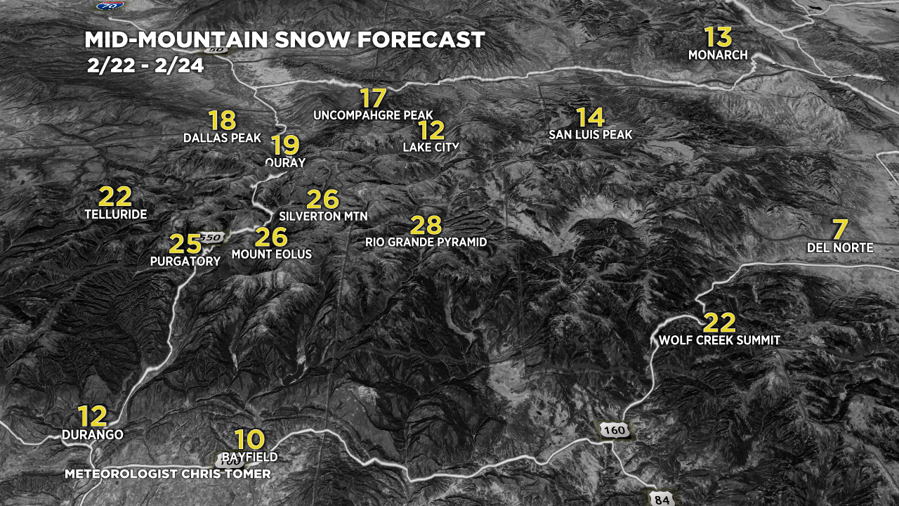
Zoom of Southern Colorado, 2/22-2/24:

Forecast snow plume for Taos, NM:

Forecast snow plume for Alta, UT:

Northeast, 2/22-3/3:
Most of this accumulation occurs on 2/25 and 3/3.

For more analysis please watch my forecast video:

I have been enjoying the Taos Ski Valley updates, and thanks for your support of my daughter, Sarah Strattan.
Thanks, Gaar! I’ve been trying to add a few more places into my discussions like Taos. It looks like a great week down there. Chris
I have been enjoying the Taos Ski Valley updates.
Whether it’s a video, news report, blog, or post on Facebook, we are committed followers. And now we have our friends in Northfield New Hampshire following you, so they can see the snow totals to come at Ragged Mountain.
Thanks, CBH! Chris
Thank you.