Tomer’s Take
- Abnormally warm temps are likely this weekend across the West with 50s and 60s at the base of many ski areas.
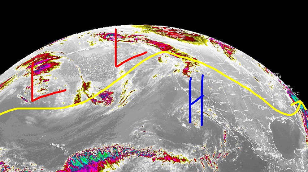
- High pressure stays in control through 3/28 then a storm system hits CA and moves east, 3/28-4/1. Confidence is low on what happens after 4/1.
- This storm system runs into a very warm airmass and precipitation starts as rain in some mountain valleys before changing to snow.
Infrared satellite shows the storm track and high pressure anchored over the West.

After 4/1
Confidence is low with mixed data, but it’s possible high pressure rebuilds across the West. This is one possible outcome.

Snow Forecast
3/25-3/28:

3/29-4/3:
This outcome assumes a stormier pattern after 4/1 rather than high pressure rebuilding.

Northeast, 3/25-4/3:

For more analysis please watch my forecast video: