Tomer’s Take
- A warm March storm system is moving through the Intermountain West. Snow levels start high then gradually drop. This will cut down on overall accumulation.
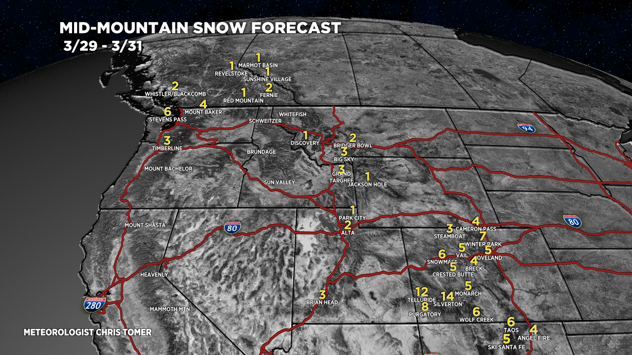
- The biggest totals occur in Colorado above 9,000ft where 4-12″ is possible.
- A second smaller, minor storm system races through 3/31-4/1.
- A similar small, minor storm system races through 4/3-4/4.
- All three storm systems lack significant cold air.
Infrared satellite shows the storm track and storm systems lined-up.

2″ of new snow at Snowbird and Alta. Another 1-2″ possible.

Snow continues at Wolf Creek where 12″ is possible by Noon Wednesday.

Snow Forecast
3/29-3/31:

4/1-4/7:

Northeast, 3/29-4/6:

For more analysis please watch my forecast video: