Tomer’s Take
- Two storm systems will be separated by a 2-3 day dry break.
- First storm system: 2/15-2/17
- Second storm system: 2/20-2/23
- Second storm system appears stronger, colder.
- End of February: High pressure might rebuild across the West.
Water vapor satellite shows the storm track and high pressure dislodged but the first western storm system. 2nd storm system waiting in the wings over the Pacific. Orange/red = drier air aloft.

2nd Storm System
Below, notice the forecast pressure drop across the West. This occurs 2/20-2/23.

End of February
Data suggest high pressure might rebuild after the 2nd storm system through the end of February. Below, notice the higher forecast pressure anomalies. March might come in like a lamb.

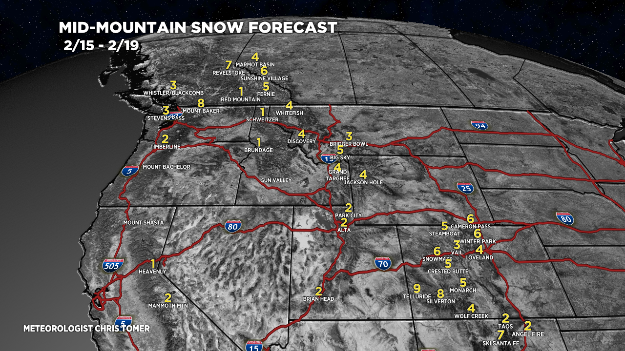
Snow Forecast
2/15-2/19:
I’ve shaved (down) the Wasatch numbers for three days straight.

2/20-2/24:

Snow plume forecast for Cameron Pass, CO:

Northeast, 2/15-2/24:

For more analysis please watch my forecast video:

Looks like models have backed off quite a bit… Big Sky numbers sliced in half from yesterday’s totals….any outliers providing some surprises to the upside again?
We’ll see how deep the trough digs on the 2nd storm. First storm battles the high pressure ridge and loses some power. Chris
I’ve got a trip planned to telluride where we were planning to arrive the morning of the 22nd. Any idea on the timing and how treacherous the drive from Georgetown to telluride would be in the early morning? Worth trying to get there the night before?
Hi Campbell – Right now it looks like snow starts in Telluride very late on 2/21 with the bulk of snow falling on 2/22 and 2/23. Snow starts earlier on 2/21 along I-70 at the Eisenhower Tunnel. Chris