Tomer’s Take
- It now looks like a two-storm combo for next week, 2/20-2/24 across the West.
- They are colder, windier, and stronger storm systems versus the one that just moved through the Intermountain West.
- Big totals possible in West/SW CO and Northern NM.
- What happens after 2/24? Data remains split and confidence is low. High pressure might rebuild.
Water vapor satellite shows the storm track and next low pressure lined-over the Pacific. Orange/red = drier air aloft.

Next Week
A second storm system appears to piggy-back on the initial low pressure. This creates a larger window of snow potential for some areas (especially West/SW CO and Northern NM) between 2/20-2/24.
Below, notice the significant forecast pressure anomalies on 2/22 across the West. This generates a colder, windier storm system(s).

Beyond 2/24
Data remains split and confidence is low.
One possible outcome involves high pressure rebuilding across the West through March 1.

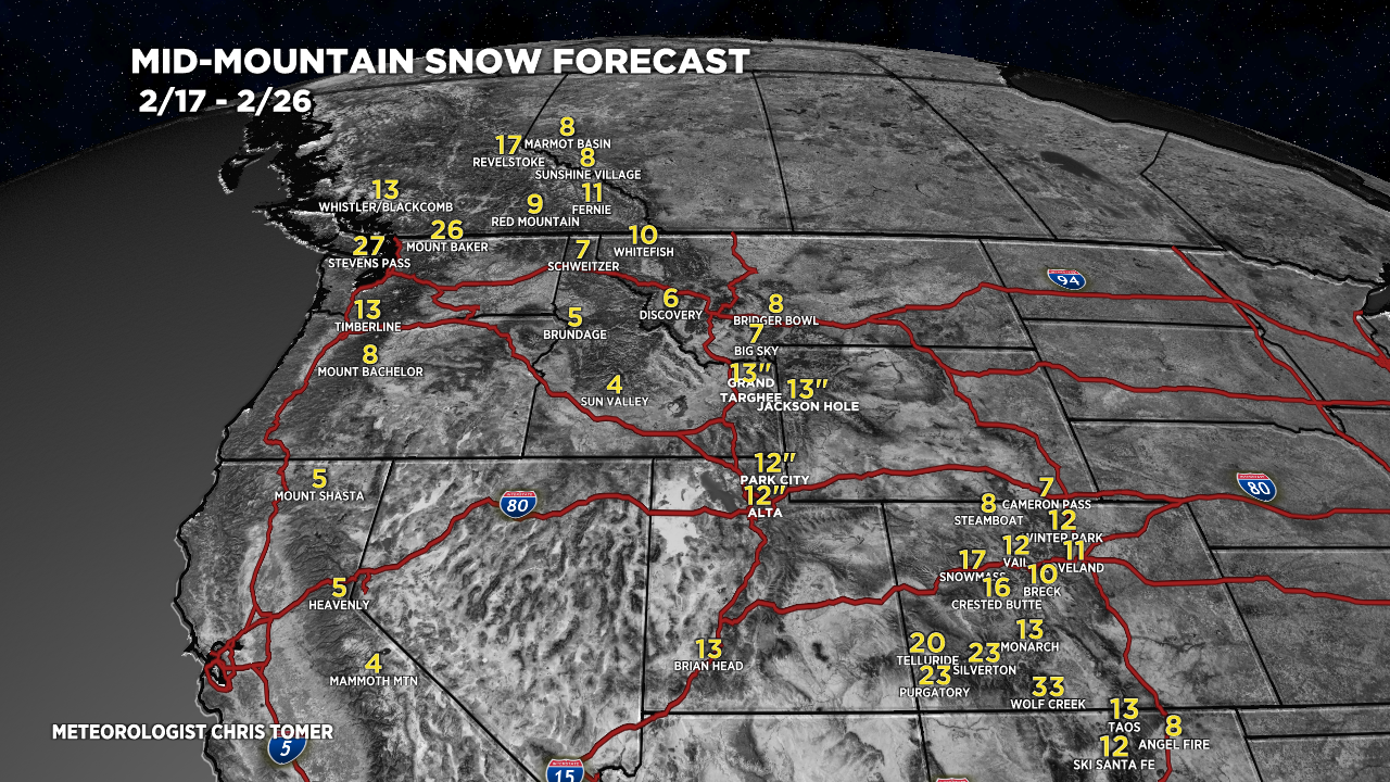
Snow Forecast
2/17-2/26:
I added Purgatory and Breckenridge to the map.

Forecast snow plume for Wolf Creek, CO:

Northeast, 2/17-2/26:
At least 50% of this accumulation occurs with a potential storm system on 2/25-2/26.

For more analysis please watch my forecast video: