Tomer’s Take
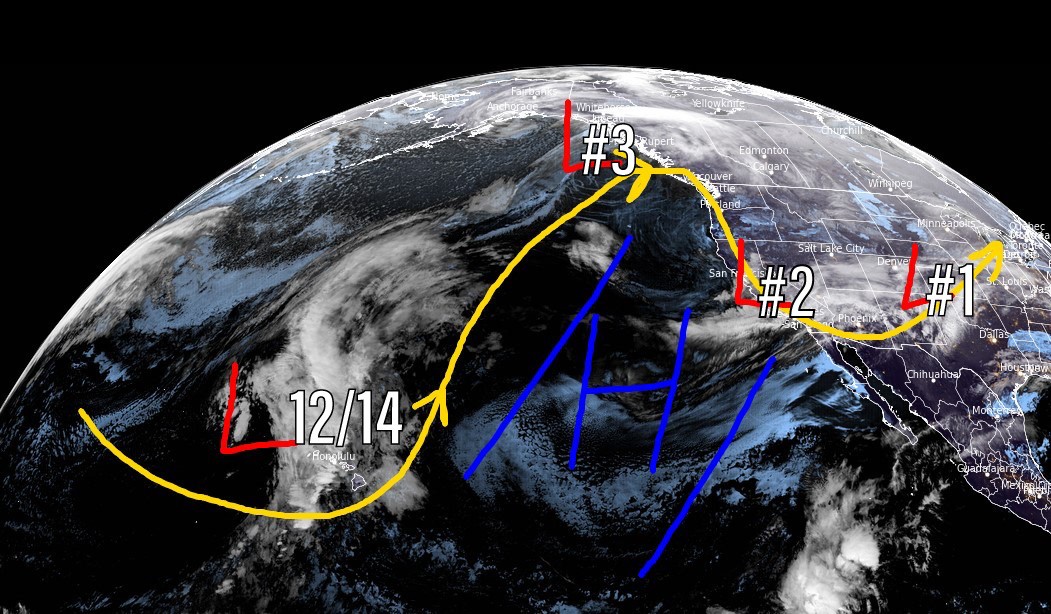
- 2nd storm system Wednesday-Thursday is minor and fast-moving.
- 3rd storm system is the main event 12/9-12/10 with moderate to heavy snow accumulation in UT, CO, and northern NM. It’s a colder and windier storm system, which will help with snow efficiency.
- Next storm system hits California with heavy rain/snow on 12/13-12/14 then moves into the Intermountain West 12/14-12/15.
- This storm system could turn into an atmospheric river setup for California.

Let’s look at storm #3. It’s the final storm of this cycle for the Intermountain West. Atmospheric pressures are forecast to run two standard deviations below the 30-year average. This means it’s strong.

Let’s look at my forecast snow totals in two timeframes.
Forecast mid-mountain totals 12/7-12/11:

Forecast mid-mountain totals 12/12-12/15:

Drilling down, here’s my snow plume forecast for Crested Butte.

For more analysis, here’s my forecast video.

Are you fairly confident this snow will not get delayed until Friday into Saturday? I am about to change my flight from Friday morning to Saturday morning mainly because I don’t trust driving from 9200′ in mid gilpin county to DIA in the dark for an early flight. Plowing doesn’t start up here anymore until 3 am. Thanks
Hi Sherri, most of the snow occurs in Denver on Friday morning. In Gilpin at 9200′ it could snow through Friday afternoon then turning drier into Saturday morning. Chris
Hi Chris! After this week, would it be enough snow to open Vail bowls? We know you are skier ?⛷?
Thank you!
Hi Claudia –
Parts of the Back Bowls are bare as I type this. Even if Vail’s Back Bowls gets 16″ i’m not sure if that’s enough. I guess we’ll see! Chris
Exquisite forecasting sir. Thank you for putting WC ahead of CB in your snow totals. Don’t let me catch you predicting more snow for CB over WC ever again. They don’t call it the most snow in Colorado for nothing! Gosh the weather just rolls in over that ridge and dumps! See ya’ll at Aspen on the 21st, and at SLC the 26th!
Thanks, Randall! Chris