Tomer’s Take
- It’s a powder Friday in Utah’s Wasatch with 6-13″ new in the last 24 hours.
- Light to moderate snow continues in the Tetons through Friday night.
- Light snow accumulation in the Central and Northern Mountains of Colorado on Friday.
- 3 storm systems lined-up for the West Coast through Christmas with heavy snow accumulation in CA, OR, WA, and B.C..
- There appears to be weak to moderate atmospheric river influence in the PNW and CA during this storm cycle.
Let’s take a closer look at the Wasatch. Alta’s season total just surpassed 60″. According to Professor Jim Steenburgh at the University of Utah this is important.
I almost attended the University of Utah for meteorology but ultimately chose Valparaiso University. I was honestly worried I would ski and climb too much!
Let’s take a look at the storm track. It’s loaded with storm systems for the West Coast through Christmas. You can see the storm system sliding through Utah, Wyoming, and Colorado this morning.

Let’s look at the Christmas pattern. There is a significant drop in atmospheric pressures and dip in the jet stream 12/22-12/25 across the West. Notice the red low pressure off the West Coast.

Snow Forecast
Let’s look at my snow forecast in two timeframes.
12/17-12/20:

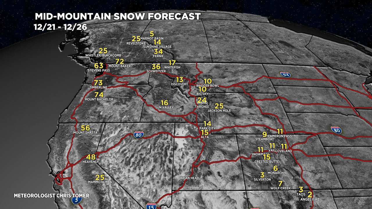
12/21-12/26:

Let’s drill down, here’s my snow plume forecast for Loveland Ski Area in Colorado.

For more analysis please watch my mountain weather forecast video:
Any chance winter park will start to see more accumulating storms?
Northern Mtns were great Friday for some backcountry. 12 degrees and very windy at times. A few inches of fresh on 2-3 ft. Not as much as previous years.