Tomer’s Take
- Snow continues early today in NH, ME.
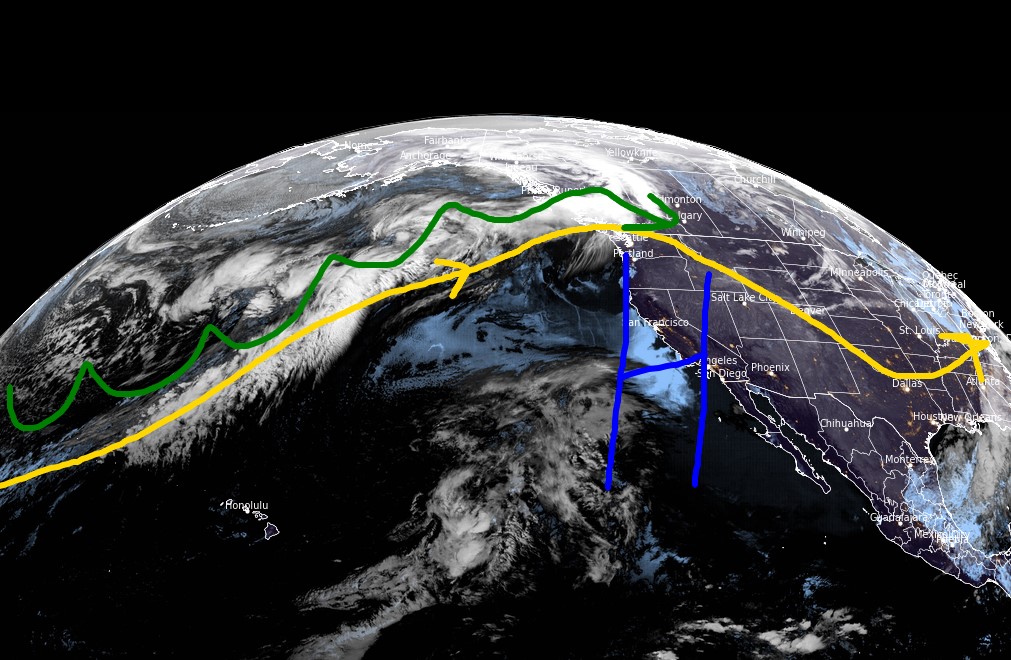
- Western high pressure keeps snow chances low through 2/13.
- Minor snowfall with a cold front races through MT, WY and into Colorado’s Central and Northern Mountains on 2/11.
- More active pattern possible after 2/14 but the signal isn’t major.
- In the Northeast, Alberta Clippers likely through 2/13.
Infrared satellite shows the storm track and large Western high pressure.

Long Range
I’m still watching for a more active pattern across the West after 2/14. The change doesn’t look major, the signal might be short-lived, and confidence is middle of the road.
You’re looking at forecast pressure anomalies valid 2/16.

Snow Forecast
2/8-2/13: I added Red Mountain, BC to the map.

2/14-2/17:

Northeast, 2/8-2/17:

For more analysis please watch my forecast video:

Hey Chris
Awesome work with your forecasts. One of the bigger reasons that I like your forecast, is that it is more holistic to how the weather is acting. Not just focused on the larger ski areas in the USA. Being from north of the 49th. Calgary area. It is great to see how our western Canada resorts will be or not, treated with some fresh snow.
Been watching this for about the last year. Your forecasts have been really really close to actual events. Fernie in particular. Sometimes even being more accurate than what the local on mountain snow safety models have said.
Good work.
Thanks
Dean
Thanks, Dean! Appreciate the note. I’m not as plugged into B.C./Banff as other ski areas, so hearing your analysis is valuable. Chris
I agree with Dean. Great and reliable forecasts. Chris, I hope you continue to provide the weather for years to come and I can get out and ski.
Thanks, Kevin! I hope to do this for a long time. Chris