Tomer’s Take
- Nor` Easter on tap for this weekend, but track could be too far east and pull the biggest snow away from many ski areas.
- Minor cold front races through CO and NM on 1/27.
- Larger storm system possible for the Intermountain West the first few days of February.
- Pattern change with lower pressures across the Intermountain West could last from 2/1 through 2/10 then higher pressures might return.
Nor` Easter
My latest forecast totals pull the heaviest snow away from the major ski areas and closer to the coast. If the track of the low pressure shifts further west then big totals return.

The latest water vapor satellite shows the storm track and developing low pressure off the Carolina coast. A cold front should merge with this low and generate a deeper low pressure.

February
It looks like the first 10 days of February turn more active across the Intermountain West. Then data reverses this after the 10th with higher pressures returning.
In the forecast image below, you’re looking at a very active jet stream early February.

Possible reversal is now evident in the Pacific North American Pattern (PNA). The Euro is even more bearish with a flip back to positive values before the 10th.

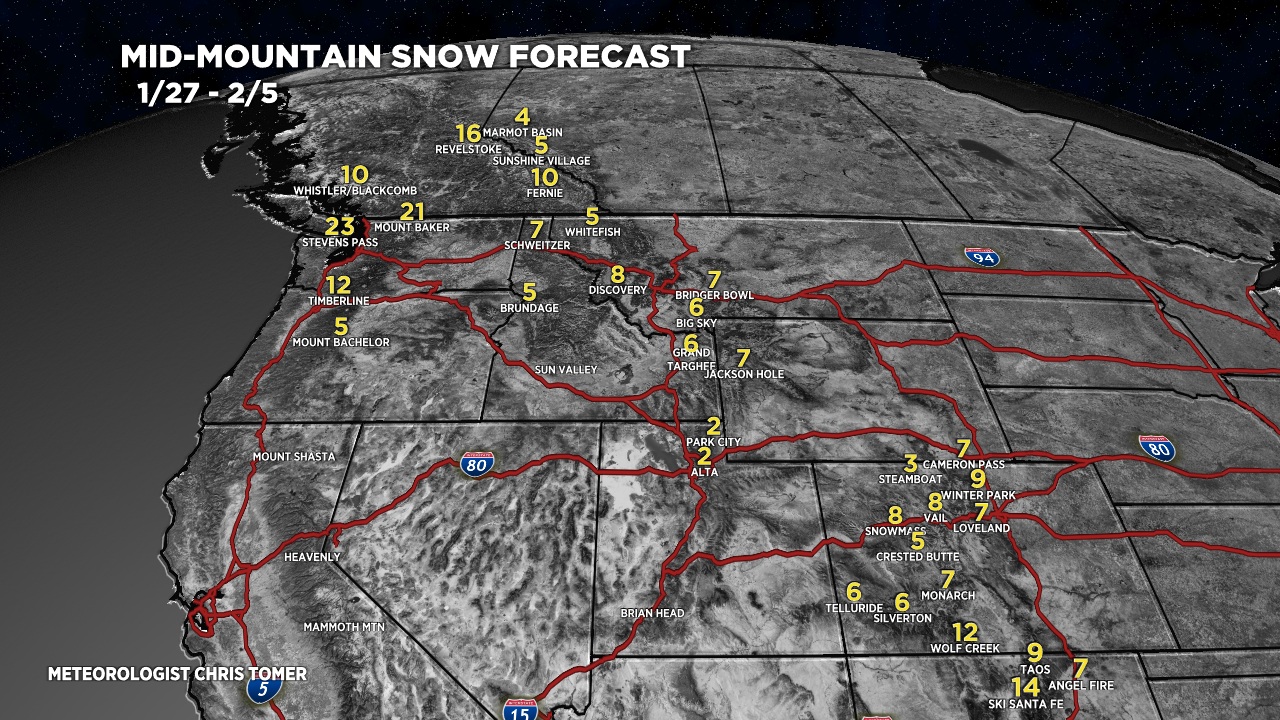
Snow Forecast
1/27-2/5:

For more analysis please watch my forecast video:

MVM (most valuable meteorologist) A.K.A. Tomer Time for Tomer’s Take
Love my 5 minutes on the blog and the tube’ daily = Rain/Sleet/Snow/Shine
1st of all great forecasting during Dec 21st-Jan6th, had a blast at Aspen then at DV, Alta, and Snowbird.
Do you envision good pow days at Snowshoe during the next week and will WV get more snow than CO during Feb 4th-8th time frame?
Appreciate any feedback.
Cheers! Randall
Thanks, Randall! I think Snowshoe could see significant snow between Wednesday-Friday (2/2-2/4). Then colder air settles in 2/4 and beyond. Chris