Tomer’s Take
- Potential Nor` Easter this weekend. Track remains in question. I look at the worst case scenario below.
- A cold front is currently racing through CO and into NM next 24 hours.
- February might deliver a stormier pattern across the West. Confidence took a hit with some data now bearish. For now we’ll assume February turns stormier.
Colorado sunshine greeted me yesterday (Monday) for a trail run in the Foothills. Now it’s snowing and 28 degrees!

Infrared satellite and storm track. Notice the cold front piercing the eastern periphery of the high pressure ridge.

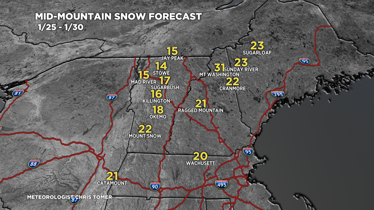
Potential Nor` Easter
Data is split on whether a major storm system will hit the Northeast this weekend. I’ll play out the worst case scenario assuming a perfect storm track. An imperfect track would reduce these numbers significantly.

Snow Forecast
1/25-1/28:

1/29-2/3:

For more analysis please watch my forecast video: