Tomer’s Take
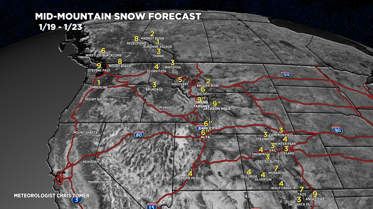
- Cold front races north to south through MT, WY, UT, CO, and NM between Thursday-Friday-Saturday morning with light to moderate snow accumulation.
- Another cold front possible 1/24-1/25.
- The Northeast stays cold with light snow chances and lake-effect snow. A larger storm system stays far enough off the coast to miss the big ski areas this weekend.
Infrared satellite shows the storm track. These cold fronts are sneaking through the eastern periphery of the high pressure sitting over CA/NV.

Snow Forecast
Let’s look at my snow forecast in two time periods.
1/19-1/23:

1/24-1/28:

