Tomer’s Take
- Snow continues in MT, ID, WY on 3/8-3/9.
- Then snow hits UT, CO, NM late 3/8 through early 3/11.
- High pressure rebuilds briefly.
- Storm track shifts north 3/13-3/18 into the Pacific Northwest (PNW), British Columbia (B.C.), Banff Area, ID, MT, WY. Feet of snow accumulation likely at Whistler/Blackcomb, Stevens Pass, Mount Baker, Mount Rainier. This appears to be a weak atmospheric river setup. Snow levels will have to be watched.
- Only light snow for UT, CO, NM, CA 3/12-3/17.
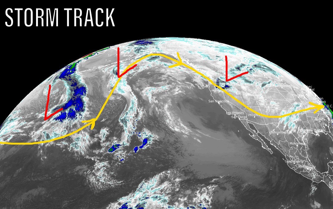
Infrared satellite shows the storm track and next storm system diving south through MT, ID, WY into UT, CO, NM.

Beyond 3/17
We might see a cut-off low pressure system around 3/18. This would generate snow and colder temps across the Intermountain West. Below, notice the forecast low pressure anomalies valid 3/18.

Snow Forecast
3/8-3/11:

3/12-3/17:

Northeast, 3/8-3/17:
It now looks like a colder storm hits 3/12 delivering 90% of these totals.

Thank you so much for doing this blog and the YouTube videos! This really helps us as we live in the mountains and frequently travel!
Thanks, Vickie! Chris