Tomer’s Take
- The West is largely dominated by high pressure. A few small cold fronts will sneak through the eastern periphery through 1/23 with minor snow accumulation in MT, WY, UT, and CO.
- Ski the Northeast this Sunday-Monday with a Nor` Easter on tap.
- When will this pattern change for the Intermountain West? It could be a long wait and confidence is low. Potentially by 1/29 or later.
Infrared satellite shows the storm track and lack of activity across most of the West.

Looking down the road
A few small cold fronts will sneak through the eastern periphery of the Western high pressure. But, a larger pattern change could be a long way off. Below is one possible scenario around 1/29 with lower pressures building across the Intermountain West.

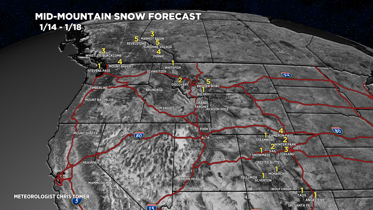
Snow Forecast
Let’s look at my snow forecast in two time periods.
1/14-1/18:
1 small cold front sneaks through with minor snow in MT, CO.

1/19-1/23:
1-2 cold fronts sneak through with minor snow in WY, MT, UT, CO.

For more analysis please watch my forecast video:
Glad to see you writing on the Northeast Chris! I truly enjoy your passion for the mountains and weather and your analysis. Keep up the good work!
Thanks, Jon! Appreciate it. Chris