Tomer’s Take:
- Latest La Nina May readings show -1.2C water temp anomalies (NINO 3.4 region). This is the strongest May La Nina since 2000.
- This means La Nina is driving the overall Western pattern.
- Western trough stays in place through 5/13 then higher pressures rebuild.
- What about the rest of May? Lower pressures could move back in from 5/19 through 5/31.
- A powerful western jet stream keeps strong winds across the Intermountain West through 5/13 then wind relaxes.
- Blowing dust continues to be a significant problem. In some places like UT and CO this is the most dust since 2009.
La Nina
The latest forecasts keep La Nina in place through Fall 2022.
Current Setup
Infrared satellite shows the storm track and storm systems lined-up.

High Pressure Transition
High pressure rebuilds across most of the Intermountain West on 5/14.

Wind Gust Forecast
| Gusts (MPH) | 5/11 | 5/12 | 5/13 | 5/14 |
| Crestone Peak | 70 | 75 | 40 | 30 |
| Quandary Peak | 45 | 55 | 45 | 35 |
| Mount Sneffels | 60 | 50 | 30 | 30 |
| Humphreys Peak | 60 | 30 | 25 | 30 |
| Wheeler Peak | 45 | 50 | 40 | 35 |
| Kings Peak | 60 | 35 | 35 | 40 |
Dirty Snowpack
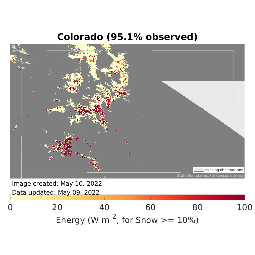
Dust radiative forcing shows just how high the dust concentration is in Colorado (orange/red dots), especially in the Southern Mountains where it’s forcing the snowpack to melt faster than normal.

Snow Forecast
5/11-5/20:


Thanks, Chris!
Chris, I have lived in Salida, CO for 41 years and am a native. I do not remember a Spring this windy. Not a break day after day. Snowpack is sad. The dust layers and evaporative loss are not good signs…
Thanks, Ira. This is the windiest period on record for several locations. The pattern is following La Nina architecture, which is the strongest since 2000 by May standards. The dust transport is destroying the snowpack in the Southern Mountains. Chris