Tomer’s Take
- 1-2 feet of snow accumulation Thursday-Friday in Utah and Colorado.
- Pacific Northwest atmospheric river (moderate intensity) delivers 25-60 inches Saturday to Baker, Rainier, Stevens Pass, Timberline, and Bachelor.
- That atmospheric river then hits California Monday-Wednesday with potentially big totals. Forecast intensity is moderate.
- Storm system hits Utah, Idaho, Wyoming, and Colorado next Tuesday-Thursday.
The current infrared satellite shows a minor low and major low. Also notice the low pressure near Hawaii. That becomes part of the atmospheric river setup this weekend into next week for the West Coast.

Looking at next week, you can see the pressure anomalies Tuesday-Wednesday (12/14-12/15).

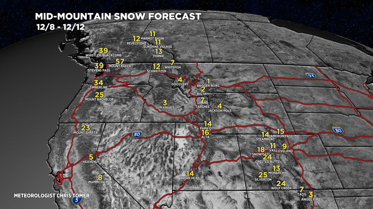
I’ll break my snowfall forecast into two timeframes.
Mid-mountain totals 12/8-12/12:

Mid-mountain totals 12/13-12/16:

Drilling down, here’s my snow plume forecast for Crested Butte, CO.

My forecast video analysis:
Hi Chris – what does the longer term snow forecast look like for NW Colorado (Steamboat) this winter. I have the option to defer my ski pass to next year if I want – but need to make up my mind by tomorrow!
Thanks,
David
Hi David, the longer term pattern appears more conducive for snow in Steamboat. Mid to late December into early January appear to place the storm track closer to Steamboat. In even broader terms, we’re in a La Nina oscillation and that tends to favor Steamboat and the Northern Mountains of Colorado. Chris
Alright! Great to see some substantial snow on the way and especially for CA where it is so much needed.
Yes! Thanks Tim and Carrie.