Tomer’s Take
- Nor` Easter remains on track for parts of the Northeast. The biggest totals appear to cover MA, NH, and ME. Moderate to heavy accumulation in VT.
- A minor cold front races through MT, WY, CO, and NM on 1/27.
- February appears to turn more active across the West with falling pressures. Will it be enough to break the long-standing high pressure dome? Data remains split.
Nor` Easter
The exact track of the low pressure determines where the heaviest snow accumulates.
Here’s one possible outcome:

February
Will we break down the Western high pressure dome? February is looking more active across the West. But, confidence is not as high as it was last week with new data turning bearish.
The GFS remains bullish most of February. Look at the forecast jet stream early February. If this plays out then expect widespread cold and snow across the Intermountain West. It continues this pattern into the 2nd week as well.

On the other hand, EPS data has softened and turned more bearish. The latest Pacific North American Pattern only briefly turns negative then back to neutral/positive. This is a change from a week ago when it was mostly negative.

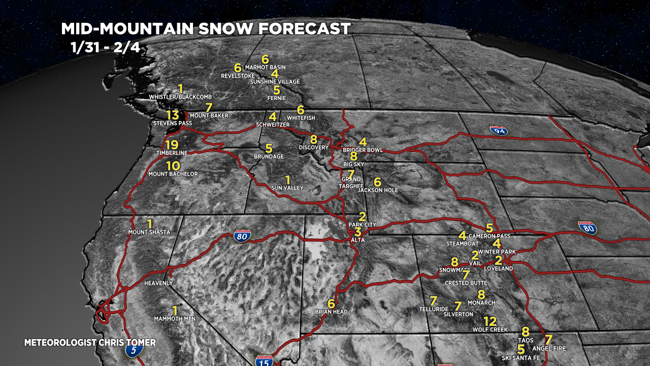
Snow Forecast
1/26-1/30:

1/31-2/4:

For more analysis please watch my forecast video:

Another little interesting ski area in s VT you may consider adding to your totals page: magic mountain. A little independent w quite a history and a cool vibe. And some damn good skiing.
Thanks, April. I just added Magic Mountain. Chris
Chris- When do you think you will have a better idea of snow activity for the Intermountain West? Specifically, Sun Valley for the week of 2/14?
Thanks, and keep up the great work! Much Appreciated.
Steve
Hi Steve, it looks like the first 10 days will be active across the Intermountain West including Idaho. Then higher pressures could return. Chris