Tomer’s Take
- The Nor` Easter track continues to wobble. I’ll assume it hugs the coast a little closer in this update favoring MA, ME, and NH.
- Out West, February arrives with a cold front 2/1-2/2 for MT, ID, WY, MT, CO, NM. It might brush Utah’s Wasatch with light accumulation.
- After this cold front, high pressure builds back and stalls. This could turn into another long-term problem.
Water vapor satellite shows the storm track and developing low pressure off the Carolina coast. A cold front sliding through Ohio will merge with this low pressure to generate a Nor` Easter this weekend.

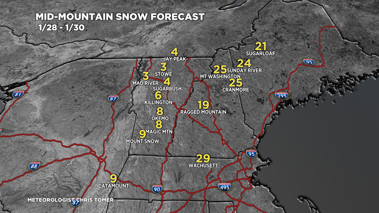
Nor` Easter
My snow forecast today assumes the low pressure hugs the coast a little closer.

If the low stays further offshore then totals go lower:

Fate of the West
I’m forecasting one cold front 2/1-2/2 then high pressure builds back in and stalls. This is not the pattern we were hoping for. California, Nevada, and Utah have been exceptionally dry for the entire month of January.
The forecast below is one possible outcome valid 2/4-2/5 with higher pressures across the West and lower pressures across the East.

Snow Forecast
1/28-2/6:

For more analysis please watch my forecast video: