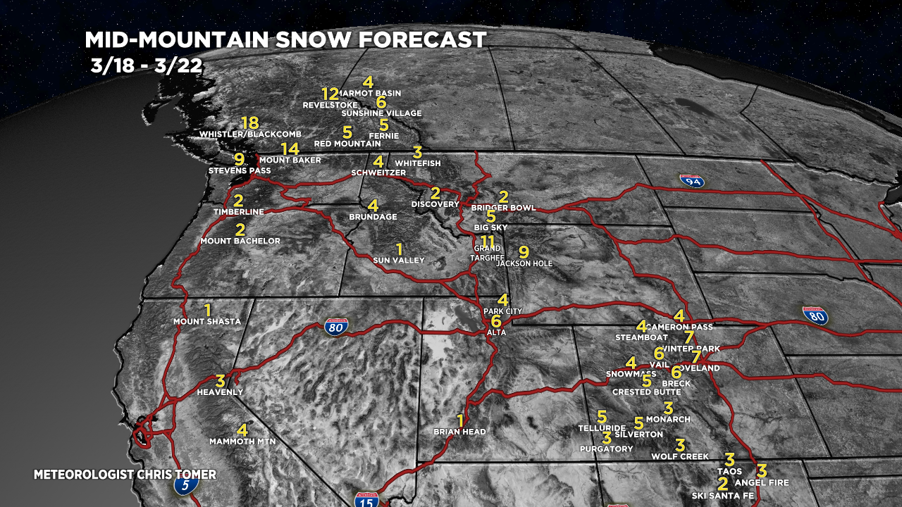
Tomer’s Take
- The next storm system hits the West Coast late 3/18 into 3/19 then moves east.
- It hits ID, WY, MT, UT on 3/19-3/20.
- It hits CO, NM afternoon of 3/20 into early 3/22.
- High pressure rebuilds on/after 3/22.
Infrared satellite shows the storm track and next storm system lined-up for the West.

3/19-3/22
The storm system has jet stream support and it’s a couple degrees colder than the previous storm system.

Snow Forecast
3/18-3/22:

3/23-3/27:

Northeast, 3/18-3/27:

For more analysis please watch my forecast video:
Looks like we may get a piece of this one. Thanks Chris!
Thanks, Vickie!