Tomer’s Take
- Storm track continues to hit the Pacific Northwest, British Columbia through 3/23.
- Two different storm systems spin-off from the PNW and roll south though CA, UT, ID, WY, MT, CO, NM.
- 1st Storm System: 3/15-3/17. This is a warmer storm system.
- 2nd Storm System: 3/19-3/21.
- Then high pressure rebuilds.
- Two warmer storm systems (3/19 & 3/23) are lined-up for the Northeast. This could push snow levels higher.
Infrared satellite shows the storm track lined-up for the PNW.

3/19-3/21
A cut-off low is forecast to sweep across the West. Below, notice the forecast pressure anomalies valid 3/21.

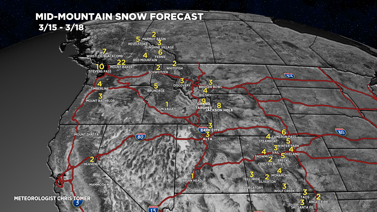
Snow Forecast
3/15-3/18:

3/19-3/24:

Northeast, 3/15-3/24:
There are two storm systems (3/19 & 3/23) and both appear warmer with higher snow levels cutting down on totals.
