Tomer’s Take
- Arctic Front hits MT, WY, ID, CO, and NM 2/1-2/3.
- This same Arctic Front develops into a storm system for the Northeast Thursday-Friday. Mixed precipitation early then changing to all snow.
- Looking ahead, high pressure appears to hold strong in CA, NV, UT. Earlier optimism about a pattern change has evaporated.
The water vapor satellite shows the current storm track and looming Arctic Front that’s headed south. The orange/reds are drier air aloft. The whites/blues are moisture aloft.

Western High Pressure
Earlier optimism about a larger pattern change for the West have evaporated. Higher pressures appear to remain over CA, NV, UT through 2/10.

The Pacific North American Pattern (PNA) has also flipped and is now more positive than negative 2/1-2/10. It trends negative by 2/14.

Snow Forecast
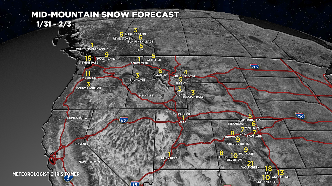
1/31-2/3:

2/4-2/9:

And, a look at the Northeast 1/31-2/6:

Thanks for mentioning Winter Park snow totals Chris!
You bet, thanks, Rose! Chris
When is Sun Valley getting in on the action??
It could be 10+ days, unfortunately. High pressure rebuilds. Chris