Tomer’s Take
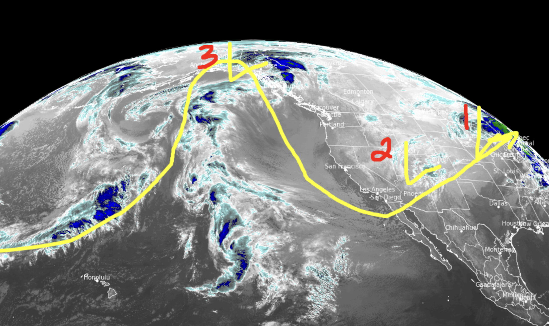
- Storm #1 was largely a bust for Wyoming and delivered lower end totals to Utah (plus some from storm #2). But, we just didn’t see the big 12”+ totals I was hoping for. Storm system was ultimately too warm and gave up pressure battling initial high pressure.
- Storm #2 (currently) is a notch colder and swinging through southern Utah, Colorado, and New Mexico will add some additional accumulation.
- Storm #3 still appears to be the colder, more potent storm system between 3/8-3/11. I’m the most optimistic about this storm out of the three.
Infrared satellite shows the storm track and three-storm-cycle for the West.

Snow Forecast
3/6-3/7:

3/8-3/15:

Northeast, 3/6-3/13:
Rain/Snow line is a problem, decreases overall forecast snow.

Forecast snow plume for Jackson Hole:
