Tomer’s Take
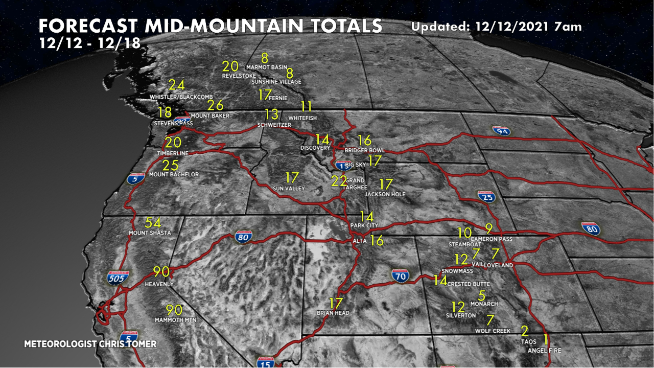
- Another 1-2 feet in the Pacific Northwest as the atmospheric river (AR) continues into Monday.
- The AR then sinks south into California’s High Sierra with 40-70 inch totals 12/12-12/14 from Shasta to Tahoe to Mammoth. The biggest totals will be above 5,000′. The higher the better.
- That storm system then breaks loose and delivers widespread 1-2 foot snow totals to the Interior Rockies of UT, ID, WY, MT, and CO between 12/13-12/15.
- In Colorado, I’m forecasting the biggest totals of a foot (or slightly more) 12/14-12/15 at the Western Slope ski areas including Aspen/Snowmass, Crested Butte, Wolf Creek, Silverton, Purgatory, and Telluride. Less Vail east into Summit County and at the Tunnel, 5-10″.
- A smaller, faster moving storm system swoops in on the heals of the AR and delivers another 6-12 inches to the High Sierra. Grand Totals by 12/17 reach 50-90 inches.
For more analysis, my forecast snow totals, and Mammoth snow plume here’s my forecast video:

Love weather
Do we have some early preview on the week of 12/19-25?
Might wanna choose between PNW and Tahoe, thanks!
Hi Ty, I’ll push the totals to 12/22 today. Will shoot for Christmas tomorrow. Chris