Tomer’s Take
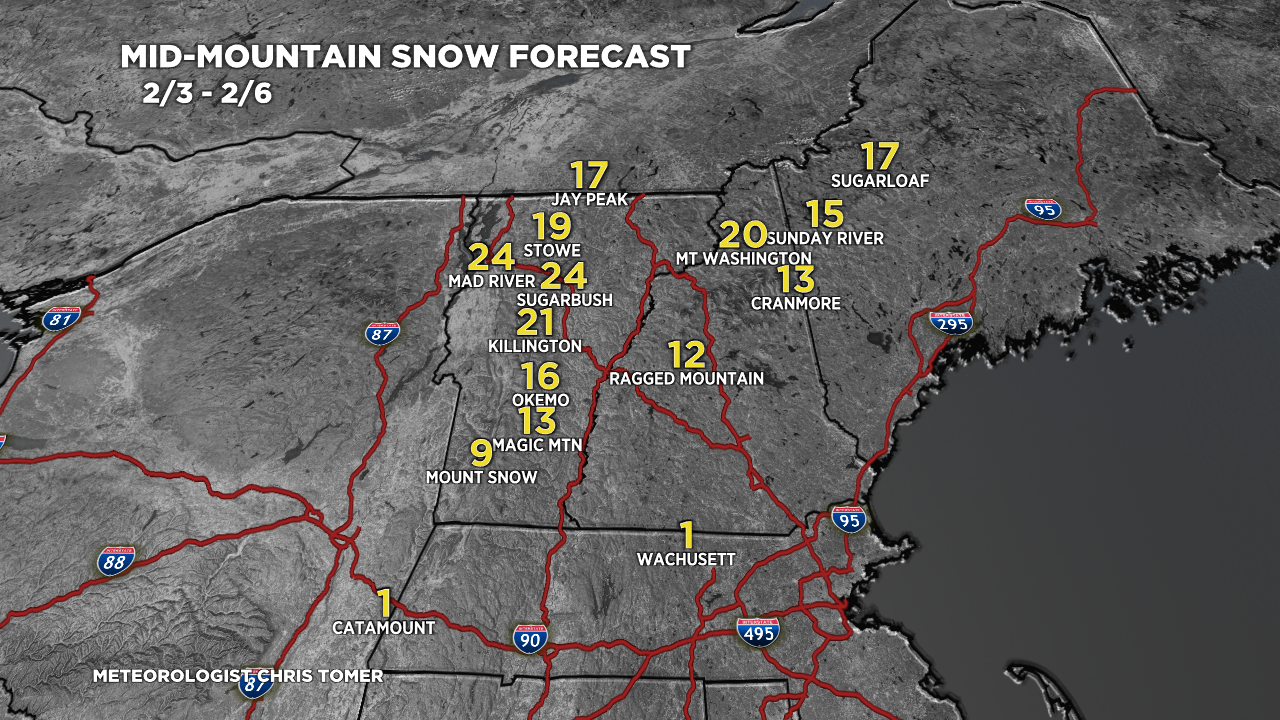
- An Arctic front delivers ice and snow to the Midwest then heavy snow to the Northeast 2/3-2/4. Great powder days 2/4 and 2/5 at the major ski areas in VT, NH, and ME.
- A weak cold front brushes ID, MT, and WY with light snow accumulation 2/5-2/6.
- Out West, high pressure rebuilds with a long dry stretch setting up for CA, NV, UT 2/3-2/13.
- Possible pattern change 2/16 or later.
Water vapor satellite shows the storm track and Arctic front.

Western High Pressure
A large dome of high pressure rebuilds across most of the West through 2/15 with possible changes thereafter. Below is one possible scenario with lower pressures returning by 2/16.

Snow Forecast
2/3-2/12:

Northeast, 2/3-2/6:

For more analysis please watch my forecast video: