Tomer’s Take
- Best snow occurs through 1/8 across the West then higher pressures build.
- Bulk of accumulation in Utah occurs on 1/5 and 1/8.
- Bulk of accumulation in Colorado occurs on 1/5, 1/6, and 1/8.
- 1-3 feet in the Pacific Northwest through 1/7.
Water vapor satellite reveals a powerful northwest flow oriented jet stream and moisture flow.

High Pressure
Higher pressures build in after this storm cycle across the West. Snow amounts will drop off dramatically.

Snow Forecast
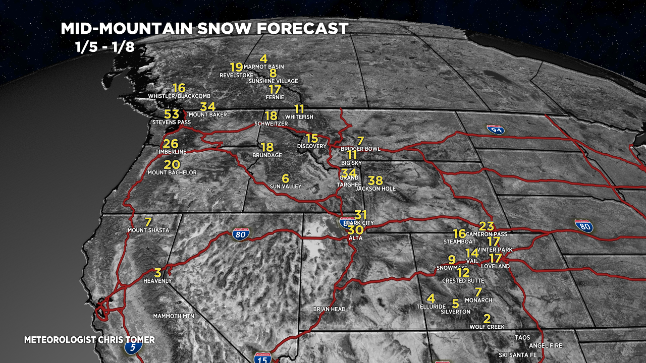
Let’s look at my snow forecast in two time-periods.
1/5-1/8:

1/9-1/13:

Drilling down, here’s my snow plume forecast for Jackson Hole, WY:

Wind
A powerful jet stream rakes the high peaks next few days then wind relaxes around 1/9.

For more analysis please watch my forecast video: