Tomer’s Take
- Storm #1 of 3 now affecting the Intermountain West. This storm cycle runs through 3/11.
- Storm #1 is the warmest of the three.
- Storm #2 is a notch colder.
- Storm #3 is the coldest and most potent. It hits the Intermountain West 3/9-3/11.
- Beyond 3/11, high pressure rebuilds briefly.
Infrared satellite shows the storm track and storm systems lined-up.

Beyond 3/12
High pressure appears to rebuild 3/12-3/15 across the West. Below, notice the forecast high pressure anomalies valid 3/15.

Beyond 3/15
The mid-late part of March might turn stormy across the West with lower forecast atmospheric pressure anomalies.

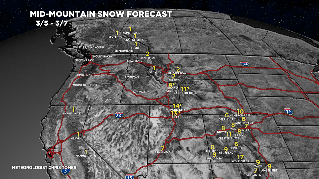
Snow Forecast
3/5-3/7:

3/8-3/14:

Northeast, 3/5-3/14:

For more analysis please watch my forecast video: