Tomer’s Take
- An Arctic front delivers snow to CO and NM on 2/2. Biggest totals occur in Southern Colorado and Northern New Mexico.
- This front then drives east with ice and snow for the Midwest and Northeast.
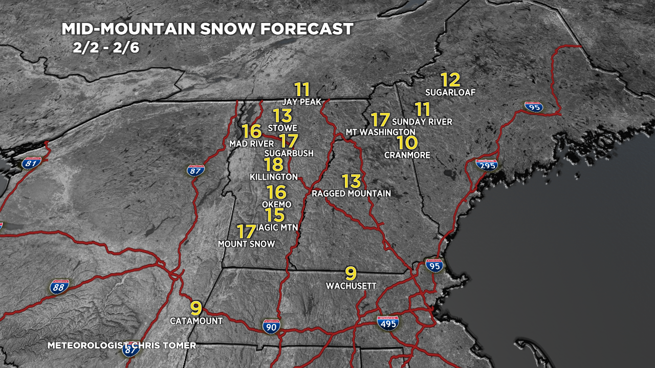
- The major ski areas in the Northeast start as rain/ice then change to all snow with significant accumulation (10-20 inches) between 2/3-2/4.
- High pressure rebuilds across CA, NV, and UT through 2/12 with possible larger pattern change by 2/17.
Water vapor satellite shows the storm track and Arctic front moving through CO, NM and draped across the Midwest.

Larger Pattern
High pressure rebuilds across the Intermountain West including CA, NV, and UT through 2/12. This means warmer, drier weather returns.

There is some indication of a larger pattern change around 2/17. Notice across the West the high pressure dome is replaced by lower pressures and a dip in the storm track. This means colder, snowier weather returns.

Snow Forecast
2/2-2/3:

2/4-2/11:

Northeast, 2/2-2/6:

Hey Chris Tomer. You are the best and my favorite meteorologist! But a note, they have renamed the Las Vegas airport for Harry Reid. I’m not happy about it but it is no longer McCarran.
Thanks, Nicole! Chris