Tomer’s Take
- Arctic front delivers snow to MT, WY, ID, CO, NM between 2/1-2/3. Biggest totals occur in CO and NM.
- This could be the biggest storm of the Winter so far in Northern New Mexico at Taos, Ski Santa Fe, and Angel Fire with 1-2 feet of accumulation.
- This Arctic front develops into a snowstorm for the Midwest and Northeast 2/3-2/4. Substantial ice and mixed precipitation likely before changing to all snow.
- High pressure rebuilds across CA, NV, UT between 2/3-2/10 and possibly longer.
Water vapor satellite shows the storm track and Arctic cold front. Orange/red colors indicate drier air aloft.

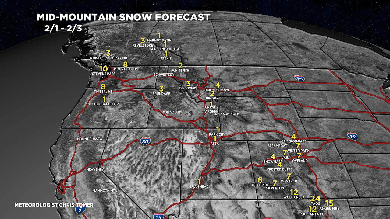
Snow Forecast
2/1-2/3:

2/4-2/10:

Northeast 2/1-2/6:

For more analysis please watch my forecast video: