Tomer’s Take
- First front is minor and hits ID, MT, WY, and CO between 1/18-1/19.
- Second front has more moisture and hits ID, MT, WY, UT, CO and NM between 1/20-1/21. Moderate snow accumulation in the Wasatch, Tetons, and Central & Northern Mountains of Colorado.
- Third front is packing colder air and hits MT, WY, UT, CO and NM between 1/24-1/25.
Infrared satellite shows the storm track. You can see how all three cold fronts will sneak through the eastern periphery of the high pressure ridge. No snow for California through 1/27.

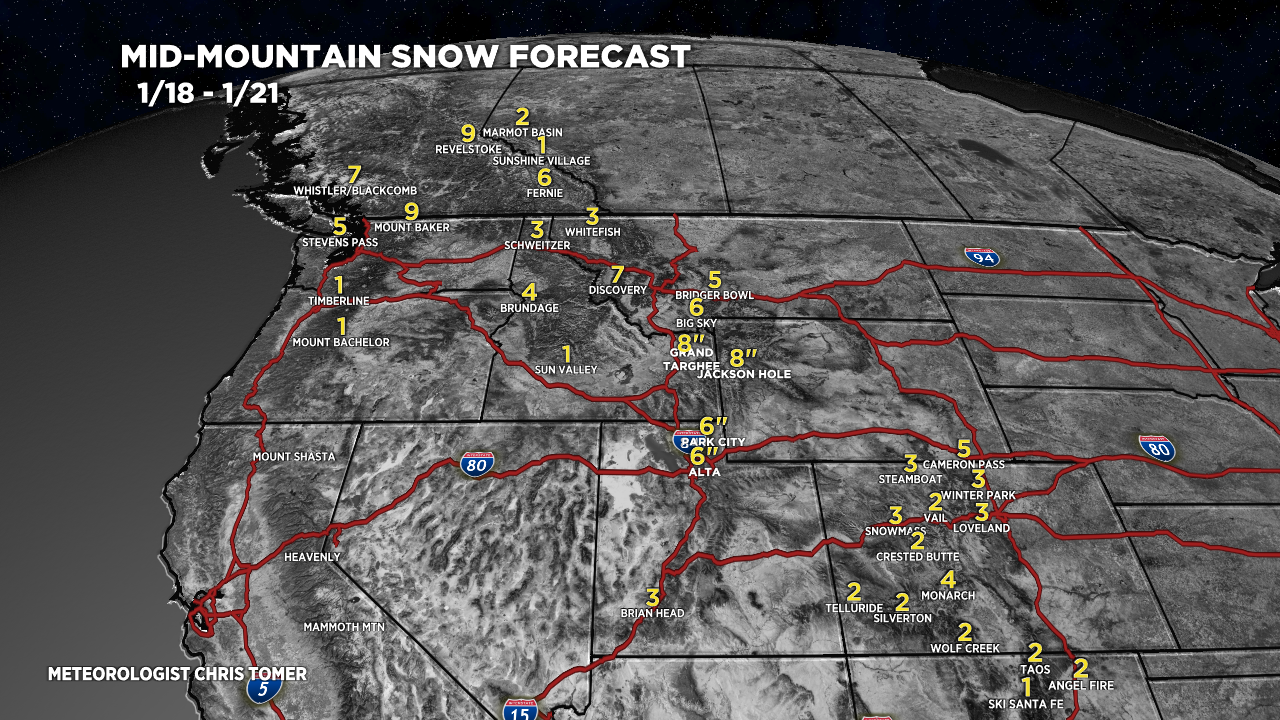
Snow Forecast
Let’s look at my snow forecast in two time periods.
1/18-1/21:
Most of this snow accumulation occurs 1/20-1/21.

1/22-1/27:
Most of this snow accumulation occurs 1/24-1/25.
