Tomer’s Take
- Reversal of fortune for the West after a 2-4 week solid storm cycle.
- Splitting jet stream and high pressure builds in through 1/18 with only minor fronts.
- Warmer and drier than normal in CA, UT, WY, CO, NM.
- Potential break in the pattern by 1/19 or later.
- The best snow with an active jet stream remains in the Pacific Northwest, British Columbia, and western Alberta.
Infrared satellite shows the splitting jet stream and large high pressure dome across the West.

When will the pattern change?
Looking down the road, high pressure dominates through 1/18 with only minor fronts for the Intermountain West. A potential change occurs around 1/19 or later as pressures drop.

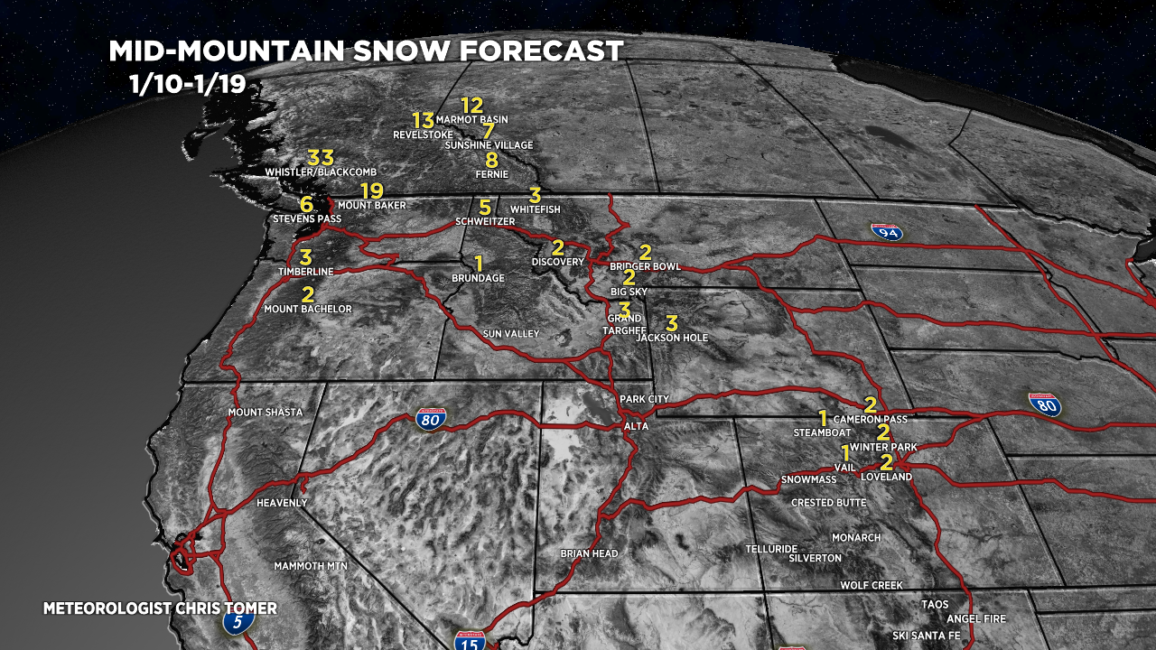
Snow Forecast
My snow forecast through 1/19 is abnormally dry for the lower 48 and Intermountain West. The 1-2″ you see in Colorado occurs with a minor front on 1/14.

Season Totals so far
