Tomer’s Take
- Storm systems are lined-up in the Pacific for the next 8-10 days.
- The storm track stays active into Christmas across the West Coast.
- The atmospheric river storm system continues Tuesday in California’s High Sierra then it slides into ID, UT, WY, MT, and CO with moderate to heavy snow accumulation and very strong wind.
- A second faster moving, smaller storm system moves into the West Coast on Wednesday-Thursday then Intermountain West Thursday-Friday.
The current storm track on infrared satellite.

I’m forecasting very strong wind Tuesday-Wednesday in Utah, Wyoming, and Colorado as a 140mph jet streak moves through. In fact, I think we could see gusts to 120mph in parts the Sangre De Cristo Mountains of Colorado. Here’s a 14er snapshot:

Christmas Pattern
Pressure anomalies are possible across the West Coast. This could mean snowfall for the High Sierra to the Cascades on/around Christmas.

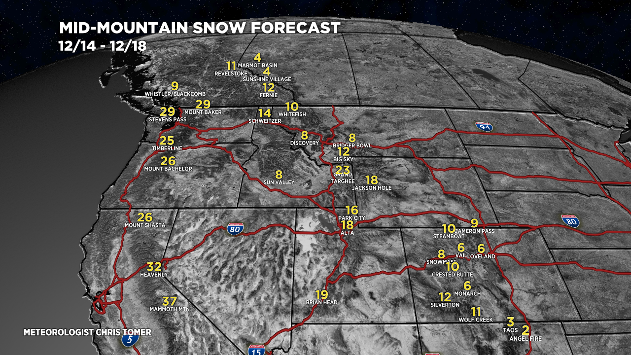
Snow Forecast
Breaking my forecast down into two time-frames.
12/14-12/18:

12/19-12/23:

For more analysis please watch my forecast video:
Thanks Chris! Question though, will the wind be a problem for ski resorts on Wednesday? Such as central/western slopes like Aspen?
Hi Rens, sorry for the late reply. Wind was atrocious yesterday. Much improved today. Next storm system delivers 1-6″ tonight – Friday in the Central and Northern Mountains. Chris