Tomer’s Take
- Atmospheric River (AR) continues in California’s High Sierra through 12/14.
- This storm system then breaks loose and delivers moderate to heavy snow accumulation to ID, WY, MT, UT, and CO 12/14-12/15.
- In Colorado, the biggest totals occur in the Southern Mountains and Western Slope ski areas.
- A second smaller, faster moving storm system hits Oregon and California’s High Sierra 12/15-12/16.
- This smaller storm then hits UT, CO, ID, WY, MT, and CO 12/16-12/17.
Heavy snow continues from Shasta to Tahoe to Mammoth. I’m forecasting 40-80 inch totals by 12/14. An additional 6-14″ with storm #2 on 12/15-12/16.

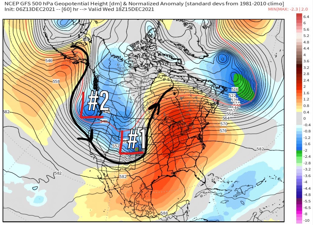
By Wednesday 12/15 you can see the atmospheric setup. Pressure anomalies cover most of the Intermountain West.
This two-storm combo delivers widespread 1-2 foot totals in Utah, Idaho, and Wyoming. 4-12 inches across Colorado.

Christmas Outlook
Looking way down the road to 12/25, the pressure pattern shows significant pressure anomalies over the West Coast. This could mean heavy snow for the Pacific Northwest and the Sierra (and potentially the interior Rockies thereafter).

Snow Forecast
Let’s break my snow forecast down into two timeframes.
12/13-12/18:

12/19-12/22:

Drilling down, let’s look at my snow plume forecast for Crested Butte, CO.

The atmospheric river storm system is packing strong wind. Here’s my forecast for the Western High Peaks.

For more analysis here’s my mountain weather forecast video:

Thank you for providing us with excellent information and not charging for it.
Thanks, Joel. I will start a subscription site for those wanting more detailed forecasts. I only have so much time for this along with another job I work! Appreciate you being a part of this! Chris