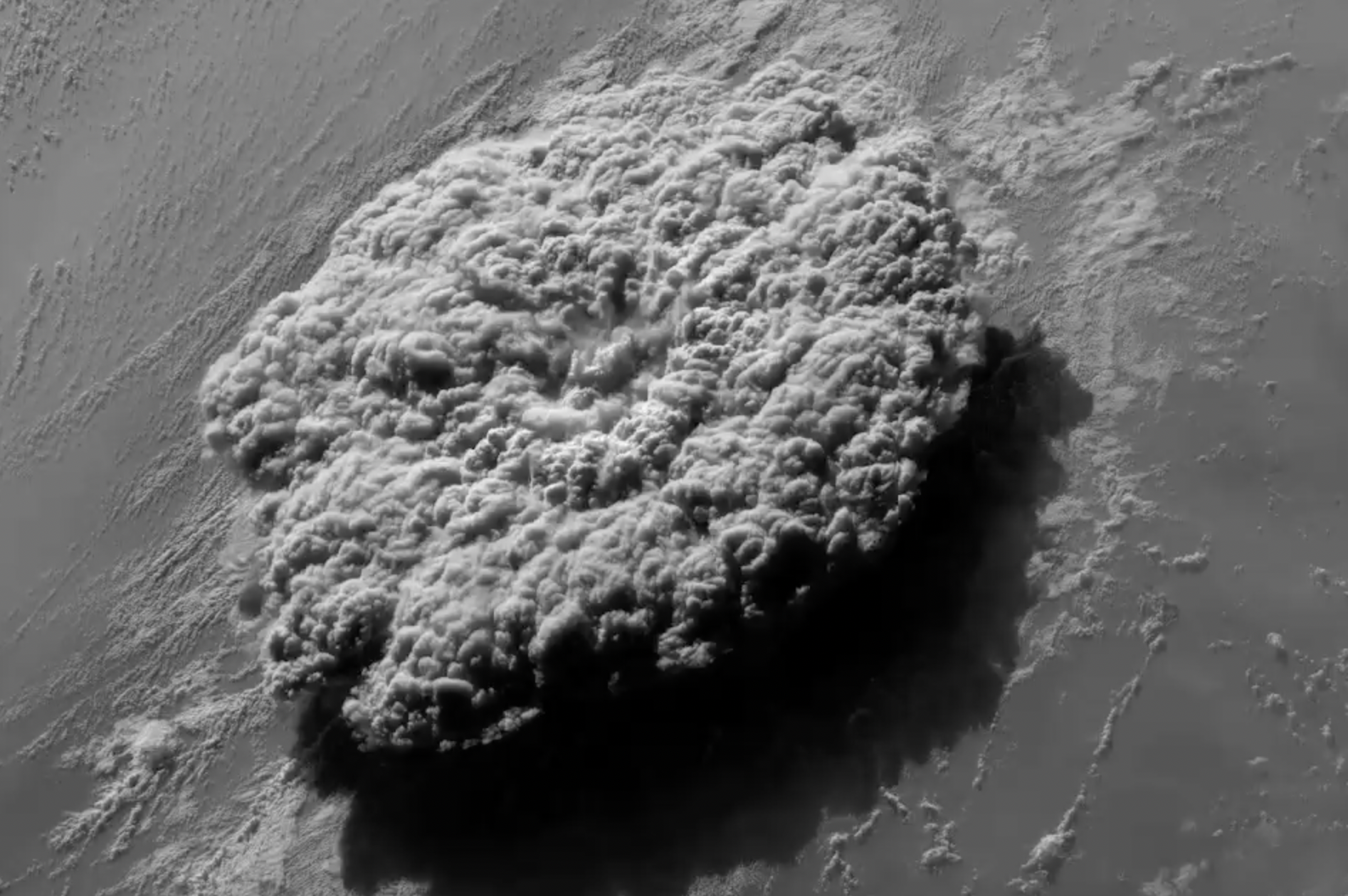
GOES-17 high resolution visible satellite captured the Hunga Tonga volcano blowing its top. How high did it shoot? Professor John Peters suggests it might’ve reached the Stratospheric canopy. That’s over 100,000 feet or higher into the vertical atmosphere.
Here’s the Infrared channel from GOES-17. Notice the shockwaves –>
The magnitude of the eruption is being called a once-in-a-decade-event. It was so powerful it sent atmospheric shockwaves around the world.
There was more than one atmospheric shockwave. I’ve seen evidence of three separate waves, at different magnitudes, at different times, and traveling at different directions like waves in a pond.
Here’s one shockwave timelapse courtesy Daryl Herzmann.

Fascinating! I know it’s a departure from mountain snow so thank you for sharing.
Thanks, Erin! Chris
Amazing! Thanks for the graphic showing the shockwaves time-lapse!
Thanks!
Chris, I am surprised the shockwave made it around the world east to west before west to east…..is there a west to east record of shockwave on the third graphic?
Thanks, Craig. It went in all directions a few times like waves in a pond starting first on Saturday then continuing to bounce around the world on Sunday. Chris